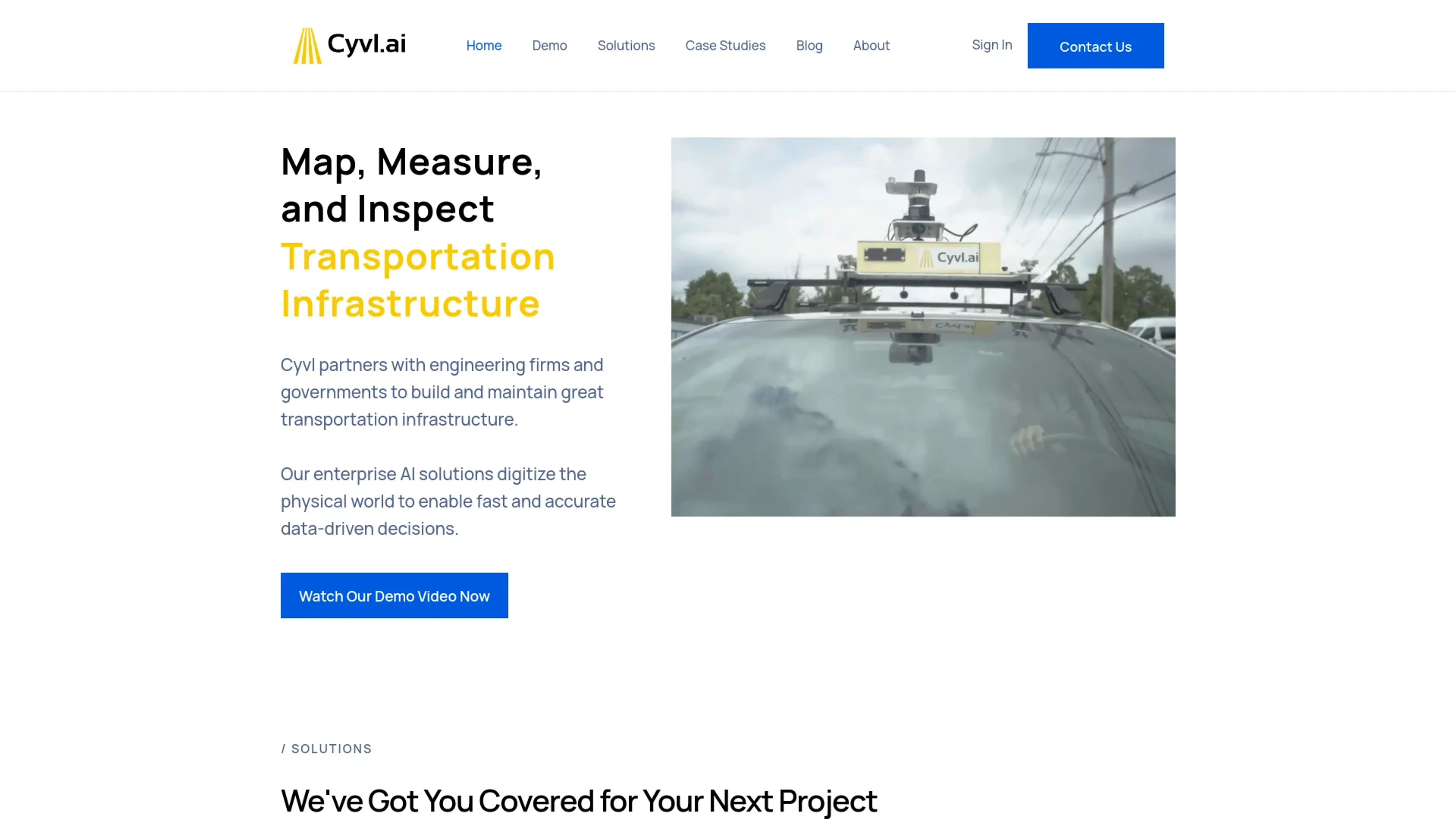
Cyvl.ai is a cutting-edge platform designed to revolutionize the management of transportation infrastructure through AI-powered mapping. By partnering with engineering firms and governments, Cyvl.ai provides tools to map, measure, and inspect the physical world with unprecedented efficiency and accuracy. This technology empowers users to make fast, data-driven decisions that are crucial for building and maintaining robust transportation networks.
360° Streetview Imagery: Offers comprehensive street-level imagery for enhanced urban analysis and planning.
LiDAR Scanning: Provides rapid 3D LiDAR scans of the built environment, significantly reducing the time required for data acquisition.
Asset Detection: Capable of detecting a wide array of Right-of-Way (ROW) assets, such as streetlights, signs, and hydrants.
Sign and Tree Inventories: Simplifies the process of inventorying traffic signs and managing urban forestry through sophisticated AI technology.
Pros
Time Efficiency: Accelerates field surveys by up to 50 times compared to traditional methods.
Cost-Effective: Reduces the financial burden of extensive manual labor and speeds up the data collection process.
Scalability: From small projects to extensive mapping efforts, Cyvl.ai's sensors adapt to various scales seamlessly.
Data Accuracy: Enhances decision-making with high-precision data and detailed geospatial infrastructure reports.
Cons
Initial Setup Requirement: Requires initial installation of sensors and setup, which might be challenging for some users.
Hardware Dependency: Reliant on specific hardware for data collection, which might limit flexibility in some scenarios.
Learning Curve: New users may need some time to fully leverage the platform's capabilities.
Who is Using Cyvl.ai?
Engineering Firms: Trusted by industry leaders for comprehensive infrastructure analysis.
Government Agencies: Employed by government bodies to oversee and upgrade transportation systems efficiently.
Urban Planners: Used by planners for detailed urban and regional development projects.
Environmental Consultants: Utilized for environmental impact assessments and sustainability studies.
Uncommon Use Cases: Adopted by academic institutions for research purposes; utilized by emergency management agencies for disaster response planning.
Pricing:
Enterprise Solutions: Custom pricing based on the scope and scale of the project.
Disclaimer: For the most accurate and current pricing details, refer to the official Cyvl.ai website.
What Makes Cyvl.ai Unique?
Cyvl.ai stands out with its integration of AI with LiDAR technology and 360° imagery, offering a comprehensive view of the physical world that is unparalleled in the industry. Its ability to provide actionable insights with rapid turnaround times sets it apart from traditional methods.
Compatibilities and Integrations:
ArcGIS Integration: Seamlessly exports data into ArcGIS for further analysis.
Civil 3D Compatibility: Works with Civil 3D to enhance civil engineering projects.
Cartegraph Integration: Syncs with Cartegraph for asset management and maintenance.
Cloud-Based Platform: Ensures easy access and collaboration via a cloud data processing platform.
Cyvl.ai Tutorials:
Explore the detailed user manuals and online resources provided on Cyvl.ai's website to get started and maximize the platform's potential.
How We Rated It:
Accuracy and Reliability: 4.8/5
Ease of Use: 4.5/5
Functionality and Features: 4.7/5
Performance and Speed: 4.9/5
Customization and Flexibility: 4.3/5
Data Privacy and Security: 4.6/5
Support and Resources: 4.5/5
Cost-Efficiency: 4.4/5
Integration Capabilities: 4.5/5
Overall Score: 4.6/5
Summary:
Cyvl.ai excels in transforming the management of transportation infrastructure with its advanced AI-driven mapping solutions. It is an indispensable tool for engineers, urban planners, and government officials alike. Its robust features, including automated assessments and comprehensive imagery, offer significant advantages in terms of efficiency and accuracy, making Cyvl.ai a leader in its field