Asseti
Drone-based building inspections help asset teams track defects across sites.
Key Takeaways
- What it is
- Drone-based building inspections help asset teams track defects across sites.
- Best for
- High-resolution 2D and 3D models
- Automated asset register
- AI defect detection
- Rating
- 4.0/5
What is Asseti?
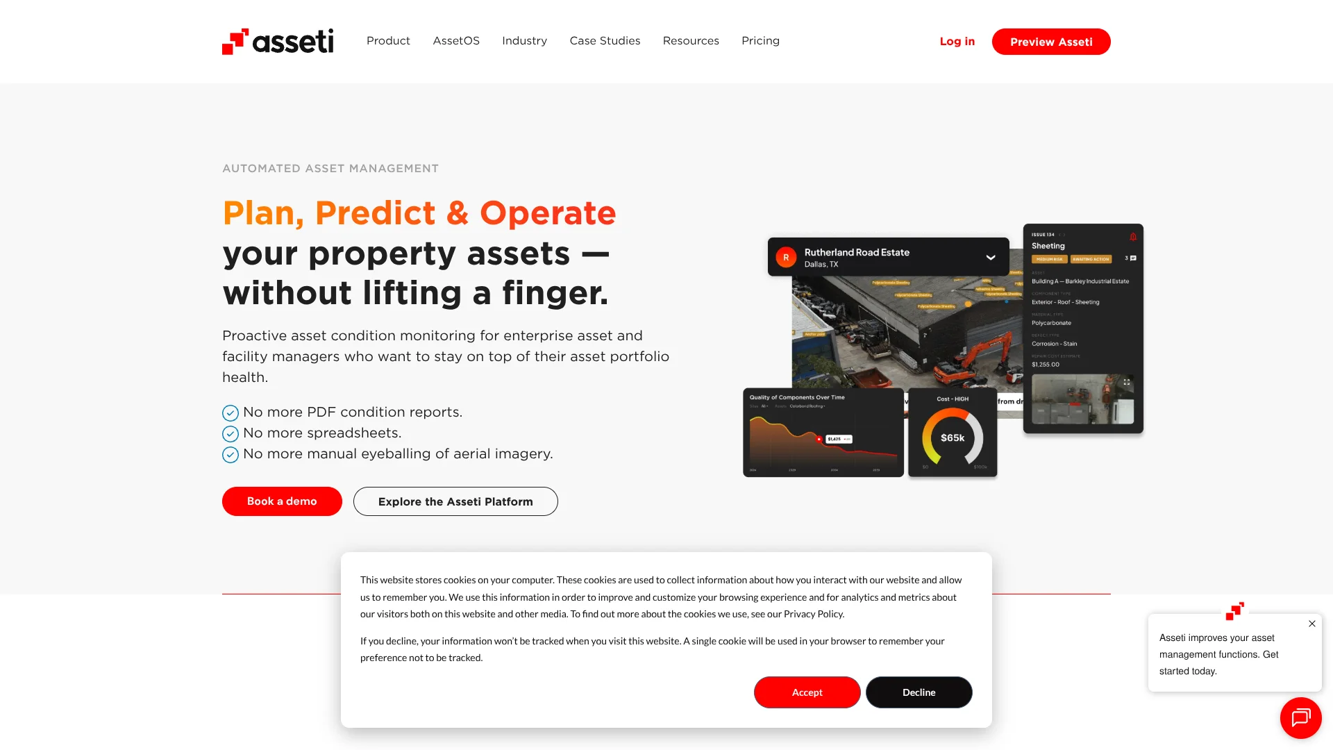
Asseti turns drone-captured aerial imagery of buildings and infrastructure into 2D and 3D models, a component-level asset register, and condition reports. Asset and facilities teams can use the AI analysis to spot defects, understand their severity, and plan maintenance across multiple sites. Asseti arranges for licensed drone operators to capture imagery, while its specialists review reports before they are published.
A specific strength is how each capture can update a detailed component register as well as identify and rank defects, with specialist review before the results reach the team. That gives asset managers a repeatable way to compare conditions across a portfolio instead of relying only on one-time inspection reports.
Asseti is best suited to commercial property and industrial organizations managing many buildings or infrastructure sites, especially when hard-to-reach areas make inspections slow or costly. It is less suited to someone seeking a low-cost, self-serve inspection app, since capturing imagery depends on coordinated drone services and pricing is quote-based.
Who is Using Asseti?
Asset managers
Portfolio condition data helps them decide which repairs to fund now and which to plan for later.
Facilities managers
Condition reports help them coordinate maintenance across buildings and communicate findings to contractors.
Reliability engineers
Component-level records and defect severity support maintenance planning for industrial structures.
Property portfolio managers
Repeated site captures help them monitor changes across properties without visiting every location.
Uncommon Use Cases
Contractor onboarding using shared site information; periodic regulatory inspections across a property portfolio.
Key Features
Rating Breakdown
Pricing Plans
Pricing model
- Rates are calculated per square foot or square meter.
- Cost depends on captured area and update frequency.
- The pricing page describes asset condition tracking, predictive maintenance, and 3D modeling as included.
Which Asseti plan should you pick?
Book a demo and request a quote based on the area to be captured and how often it needs updating; Asseti does not publish named plans or dollar rates.
Asseti Use Cases
Roof and exterior inspections
High-resolution drone imagery helps teams assess roofs and facades without sending people onto hard-to-reach areas.
Outcome: A mapped condition report with identified defects and severity rankings.
Portfolio condition monitoring
Repeated captures reveal how building and infrastructure conditions change over time.
Outcome: More current condition data for maintenance and investment planning.
Repair prioritization
Issue severity and repair estimates help teams focus attention and budgets on critical work.
Outcome: A clearer pipeline of repairs to track and plan.
Asset register creation
Drone data can be processed into a component-level record of assets across a site.
Outcome: A centralized register with component details and condition information.
Contractor coordination
Shared links and issue views give external contractors access to relevant site findings.
Outcome: Contractors and internal teams can review the same site information.
Workflow Ideas with Asseti
From site capture to repair plan
- 1Select the sites and assets to monitor.
- 2Arrange drone capture with a licensed operator.
- 3Review the checked condition report and prioritize repair issues.
Track changes across a portfolio
- 1Set a schedule for recapturing asset imagery.
- 2Compare current condition data with earlier captures.
- 3Use dashboard trends to plan maintenance and budgets.
Share an issue with a contractor
- 1Open the relevant site or defect in Asseti.
- 2Share a view-only link with the contractor.
- 3Track the issue and repair status in the platform.
How Asseti fits into your stack
Drone capture
Asseti coordinates licensed operators to collect aerial imagery of buildings and infrastructure. That imagery becomes the input for its models and condition reports.
Asset management workspace
The web app holds site information, asset registers, condition findings, and reporting dashboards for portfolio teams.
Maintenance systems
Asseti describes integration with EAM and CMMS systems, which organizations use to manage assets and maintenance work.
API and reporting
An API can provide Asseti data to an organization's own systems, while dashboards and condition reports can be customized and exported.
Field access
The Asseti iPhone app is a mobile companion to AssetOS for viewing asset condition and handling issue capture in the field.
Pros
- +Portfolio coverage: Tracks assets across many sites from a central dashboard.
- +Human-reviewed findings: Specialists check reports before they are published.
- +Component-level detail: Records asset parts, condition, measurements, and estimated end of life.
- +Contractor sharing: Shareable views help contractors review specific sites and issues.
Cons
- −Quote-based pricing: No public dollar rate makes early budget comparisons harder.
- −Capture coordination: Drone imagery depends on arranging a licensed operator.
Limitations & when to consider alternatives
Known limitations
- No public dollar rates. The pricing page describes a per-square-foot or per-square-meter model, but directs prospective customers to book a demo rather than showing a specific rate.
- Drone capture is part of the process. Asseti's inspection workflow relies on aerial imagery captured by licensed drone operators arranged through the service.
Look elsewhere when
- You need public monthly subscription prices before speaking with sales.
- You need a tool that analyzes user-uploaded photos without arranging drone capture.
How to Use Asseti
- 1
Book a demo
Discuss your asset portfolio and inspection needs with Asseti before requesting a quote.
- 2
Set up sites and monitoring
Organize the work around the locations, assets, and monitoring areas your team needs to track.
- 3
Arrange image capture
Coordinate with Asseti on drone capture by a licensed operator for the selected sites.
- 4
Review condition findings
Check the specialist-reviewed report, component register, and severity-ranked issues.
- 5
Plan and share maintenance
Track repairs in the platform and share relevant site or issue views with contractors.
Who is Asseti For?
Industrial asset owners
Large facilities and infrastructure portfolios can track defects and maintenance needs across sites.
Commercial property managers
Building teams can review exterior and component conditions without relying only on in-person inspections.
Facilities managers
Facilities teams can share condition findings with contractors and prioritize repair work.
Asset and infrastructure operators
Operators managing extensive networks can compare condition data and plan work across locations.
Frequently Asked Questions
How much does Asseti cost?
Pricing is based on the area of assets captured and processed and how often they are updated. The pricing page does not show a dollar rate, so contact Asseti for a quote.
Does Asseti integrate with maintenance systems?
Asseti says it integrates with EAM and CMMS platforms and offers API access for connecting data with other systems.
Can Asseti monitor large portfolios?
Yes. Asseti says it supports portfolios ranging from a single site to tens of thousands of asset features.
How are condition reports checked?
AI processes the imagery and identifies issues, then Asseti specialists review the report before it is published.
Is there an Asseti mobile app?
Asseti has an iPhone app described as a mobile companion to its AssetOS platform. An Asseti account is required to sign in.
Community reviews
Be the first to share your experience.
Sign in to leave a review for Asseti.
Asseti Alternatives
Looking for alternatives to Asseti? Here are similar tools in the same category: